IMAGES TAKEN NEAR TO
Highlands Close, CROWBOROUGH, TN6 1BE
Introduction
This page details the photographs taken nearby to Highlands Close, TN6 1BE by members of the Geograph project.
The Geograph project started in 2005 with the aim of publishing, organising and preserving representative images for every square kilometre of Great Britain, Ireland and the Isle of Man.

There are currently over 7.5m images from over14,400 individuals and you can help contribute to the project by visiting https://www.geograph.org.uk
Image Map
Images are licensed for reuse under creativecommons.org/licenses/by-sa/2.0
Notes
- Clicking on the map will re-center to the selected point.
- The higher the marker number, the further away the image location is from the centre of the postcode.
Image Listing (20 Images Found)
Images are licensed for reuse under creativecommons.org/licenses/by-sa/2.0
Image
Details
Distance
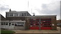
1
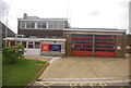
Crowborough Hill
Crowborough Hill is an English Marilyn at a height of 242m. The trig point is well hidden on water board property under the radio mast.
Image: © AlanC
Taken: 3 Jul 2004
0.11 miles
9
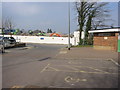
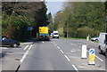
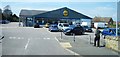
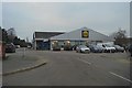
Morrisons building site Crowborough
As viewed from the Waitrose car park on March 15th 2006
Image: © David Harvey
Taken: 15 Mar 2006
0.20 miles