IMAGES TAKEN NEAR TO
Flimwell, WADHURST, TN5 7QB
Introduction
This page details the photographs taken nearby to TN5 7QB by members of the Geograph project.
The Geograph project started in 2005 with the aim of publishing, organising and preserving representative images for every square kilometre of Great Britain, Ireland and the Isle of Man.

There are currently over 7.5m images from over14,400 individuals and you can help contribute to the project by visiting https://www.geograph.org.uk
Image Map
Images are licensed for reuse under creativecommons.org/licenses/by-sa/2.0
Notes
- Clicking on the map will re-center to the selected point.
- The higher the marker number, the further away the image location is from the centre of the postcode.
Image Listing (13 Images Found)
Images are licensed for reuse under creativecommons.org/licenses/by-sa/2.0
Image
Details
Distance
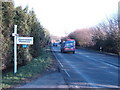
1
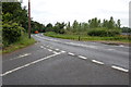
Junction of Rosemary Lane with A21
Image: © Julian P Guffogg
Taken: 15 Jul 2012
0.04 miles
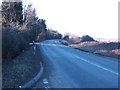
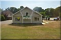
6

A21 heading south
Approaching a motel and campsite on the right, the campsite looked quite busy for the bank holiday weekend.
Image: © Robin Webster
Taken: 26 May 2018
0.16 miles
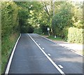
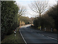
7
A21 near T&J Motel
Towards Hastings.
Image: © Julian P Guffogg
Taken: 16 Jun 2013
0.17 miles