IMAGES TAKEN NEAR TO
Upper Grosvenor Road, TUNBRIDGE WELLS, TN4 9EZ
Introduction
This page details the photographs taken nearby to Upper Grosvenor Road, TN4 9EZ by members of the Geograph project.
The Geograph project started in 2005 with the aim of publishing, organising and preserving representative images for every square kilometre of Great Britain, Ireland and the Isle of Man.

There are currently over 7.5m images from over14,400 individuals and you can help contribute to the project by visiting https://www.geograph.org.uk
Image Map
Images are licensed for reuse under creativecommons.org/licenses/by-sa/2.0
Notes
- Clicking on the map will re-center to the selected point.
- The higher the marker number, the further away the image location is from the centre of the postcode.
Image Listing (1434 Images Found)
Images are licensed for reuse under creativecommons.org/licenses/by-sa/2.0
Image
Details
Distance
4
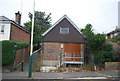
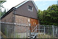
Electrical transformer, Upper Grosvenor Road
Image: © N Chadwick
Taken: 19 Sep 2009
0.01 miles
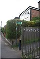
6
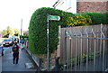
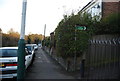
Footpath leads off Upper Grosvenor Rd, High Brooms
Image: © N Chadwick
Taken: 13 Apr 2009
0.01 miles
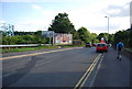
10
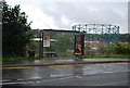
Bus Stop, North Farm Rd
The 281 stops here.
Image: © N Chadwick
Taken: 11 Sep 2010
0.02 miles