IMAGES TAKEN NEAR TO
Claytons Lane, TUNBRIDGE WELLS, TN3 9TD
Introduction
This page details the photographs taken nearby to Claytons Lane, TN3 9TD by members of the Geograph project.
The Geograph project started in 2005 with the aim of publishing, organising and preserving representative images for every square kilometre of Great Britain, Ireland and the Isle of Man.

There are currently over 7.5m images from over14,400 individuals and you can help contribute to the project by visiting https://www.geograph.org.uk
Image Map (Loading...)


Getting Data...Please wait
Leaflet Map data © OpenStreetMap
Images are licensed for reuse under creativecommons.org/licenses/by-sa/2.0
Notes
- Clicking on the map will re-center to the selected point.
- The higher the marker number, the further away the image location is from the centre of the postcode.
Image Listing (106 Images Found)
Images are licensed for reuse under creativecommons.org/licenses/by-sa/2.0
Image
Details
Distance
5
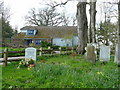
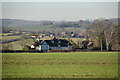
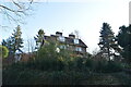
Ashurst village hall
Viewed from the churchyard.
Image: © Jonathan Billinger
Taken: 17 Apr 2008
0.11 miles
6
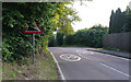
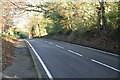
Ashurst Hill - Steep Hill 11%
Ashurst Hill, Ashurst. 11% steep hill down sign.
Image: © Adam Morse
Taken: 8 Jul 2009
0.11 miles
9
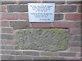
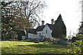
Ashstead Village Hall: plaque and stone
Image: © Basher Eyre
Taken: 10 Feb 2017
0.12 miles