IMAGES TAKEN NEAR TO
Wallis Field, Corseley Road, TUNBRIDGE WELLS, TN3 9SQ
Introduction
This page details the photographs taken nearby to Wallis Field, Corseley Road, TN3 9SQ by members of the Geograph project.
The Geograph project started in 2005 with the aim of publishing, organising and preserving representative images for every square kilometre of Great Britain, Ireland and the Isle of Man.

There are currently over 7.5m images from over14,400 individuals and you can help contribute to the project by visiting https://www.geograph.org.uk
Image Map
Images are licensed for reuse under creativecommons.org/licenses/by-sa/2.0
Notes
- Clicking on the map will re-center to the selected point.
- The higher the marker number, the further away the image location is from the centre of the postcode.
Image Listing (223 Images Found)
Images are licensed for reuse under creativecommons.org/licenses/by-sa/2.0
Image
Details
Distance
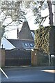
1
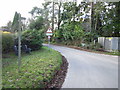
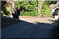
Corseley Road
The High Weald Landscape Trail follows this section of Corseley Road.
Image: © Chris McAuley
Taken: 15 Jan 2012
0.02 miles

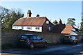
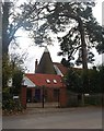
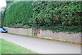
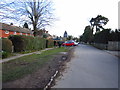
7
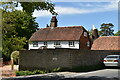
Corseley Farmhouse and Oastleigh
Grade II listed https://historicengland.org.uk/listing/the-list/list-entry/1028039
Image: © N Chadwick
Taken: 18 May 2020
0.04 miles