IMAGES TAKEN NEAR TO
Sandhurst Lane, BEXHILL-ON-SEA, TN39 4RH
Introduction
This page details the photographs taken nearby to Sandhurst Lane, TN39 4RH by members of the Geograph project.
The Geograph project started in 2005 with the aim of publishing, organising and preserving representative images for every square kilometre of Great Britain, Ireland and the Isle of Man.

There are currently over 7.5m images from over14,400 individuals and you can help contribute to the project by visiting https://www.geograph.org.uk
Image Map (Loading...)


Getting Data...Please wait
Leaflet Map data © OpenStreetMap
Images are licensed for reuse under creativecommons.org/licenses/by-sa/2.0
Notes
- Clicking on the map will re-center to the selected point.
- The higher the marker number, the further away the image location is from the centre of the postcode.
Image Listing (6 Images Found)
Images are licensed for reuse under creativecommons.org/licenses/by-sa/2.0
Image
Details
Distance
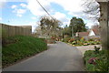
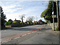
2
Sandhurst Lane, Cooden, East Sussex
Image: © Oast House Archive
Taken: 25 Oct 2008
0.12 miles
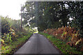
4
Farmland Nr Little Common East Sussex
View looking across farmland to Picknill Green from Sandhurst Lane which joins Conneyburrow Lane.
Image: © Janet Richardson
Taken: 11 Feb 2006
0.20 miles
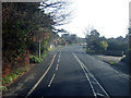
5
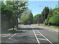
A259 Barnhorn Road junction with Sandhurst Lane
Image: © Stuart Logan
Taken: 27 May 2012
0.20 miles
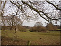
6
Barnhorn Road, Cooden, East Sussex
Image: © Oast House Archive
Taken: 25 Oct 2008
0.23 miles