IMAGES TAKEN NEAR TO
Whydown Road, BEXHILL-ON-SEA, TN39 4RF

Introduction

This page details the photographs taken nearby to Whydown Road, TN39 4RF by members of the Geograph project.

The Geograph project started in 2005 with the aim of publishing, organising and preserving representative images for every square kilometre of Great Britain, Ireland and the Isle of Man.

There are currently over 7.5m images from over14,400 individuals and you can help contribute to the project by visiting https://www.geograph.org.uk

Image Map


Images are licensed for reuse under creativecommons.org/licenses/by-sa/2.0
Notes
  • Clicking on the map will re-center to the selected point.
  • The higher the marker number, the further away the image location is from the centre of the postcode.

Image Listing (9 Images Found)

Images are licensed for reuse under creativecommons.org/licenses/by-sa/2.0
Image
Details
Distance
1
Whydown Road
Minor road from Bexhill to Hooe. Taken from Whydown Bridge and looking towards Holmes Farm Cottages.
Image: © Simon Carey Taken: 22 Feb 2008
0.01 miles
2
Upper Swin Garden
The name of the field according to Ninfield's 1844 tithe map located to the south of Whydown Road and north east of Holmes Farm.
Image: © Simon Carey Taken: 21 Sep 2019
0.09 miles
3
Holmes Farm
The farm is a meeting point for a couple of footpaths as that from Whydown to Hooe meets with those from Russell's Green and Picknill Green.
Image: © Simon Carey Taken: 22 Feb 2008
0.12 miles
4
Rick Skeddle Field
The name of the field according to Hooe's 1839 tithe map located to the immediate north of Holmes Farm.
Image: © Simon Carey Taken: 21 Sep 2019
0.12 miles
5
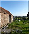
Barn, Holmes Farm
A converted barn on the western side of the farm.
Image: © Simon Carey Taken: 21 Sep 2019
0.15 miles
6
Meadow with Pashley farm in background. East of Hooe, East Sussex.
A nice spot for blackberry picking.
Image: © nick macneill Taken: 6 Sep 2009
0.16 miles
7
Farmland at Whydown East Sussex
Farmland at Whydown from the Whydown Road looking towards High Woods Nr Hooe East Sussex
Image: © Janet Richardson Taken: 29 Nov 2005
0.18 miles
8
Holmes Lane
A green lane linking the fields of Holmes Farm with the farm buildings themselves on the peak of a small hill. Taken from a small crossing of East Stream.
Image: © Simon Carey Taken: 22 Feb 2008
0.19 miles
9
Bog Field/Barn Field
The name of the fields according to Ninfield's 1844 tithe map that have been merged to form a larger unit. Bog Field was to the left and Barn Field to the right adjacent to Holmes Farm.
Image: © Simon Carey Taken: 21 Sep 2019
0.20 miles