IMAGES TAKEN NEAR TO
Robsack Avenue, ST. LEONARDS-ON-SEA, TN38 9SL
Introduction
This page details the photographs taken nearby to Robsack Avenue, TN38 9SL by members of the Geograph project.
The Geograph project started in 2005 with the aim of publishing, organising and preserving representative images for every square kilometre of Great Britain, Ireland and the Isle of Man.

There are currently over 7.5m images from over14,400 individuals and you can help contribute to the project by visiting https://www.geograph.org.uk
Image Map
Images are licensed for reuse under creativecommons.org/licenses/by-sa/2.0
Notes
- Clicking on the map will re-center to the selected point.
- The higher the marker number, the further away the image location is from the centre of the postcode.
Image Listing (39 Images Found)
Images are licensed for reuse under creativecommons.org/licenses/by-sa/2.0
Image
Details
Distance
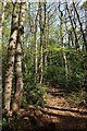
1
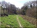
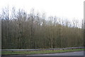
Footpath to Crowhurst Road
This path leads past Church Wood (the large local nature reserve - on the right) from Church Wood Drive and Hollington.
Image: © David Anstiss
Taken: 6 Apr 2012
0.09 miles
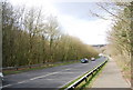
2
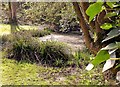
Pond at The Suttons, St Leonards-on-Sea
Image: © Patrick Roper
Taken: 11 Mar 2002
0.09 miles
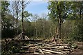
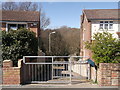
3
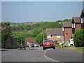
The Suttons
Cul-de-sac of houses off Wishing Tree Road, which is also a dead end road.
Image: © Oast House Archive
Taken: 24 Apr 2011
0.13 miles
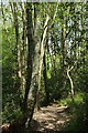
9
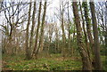
Path to Church Wood, Hastings
This path leads down from Wartling Close into the large woodland.
Image: © David Anstiss
Taken: 6 Apr 2012
0.18 miles