IMAGES TAKEN NEAR TO
Etchingham Drive, ST. LEONARDS-ON-SEA, TN38 9AB
Introduction
This page details the photographs taken nearby to Etchingham Drive, TN38 9AB by members of the Geograph project.
The Geograph project started in 2005 with the aim of publishing, organising and preserving representative images for every square kilometre of Great Britain, Ireland and the Isle of Man.

There are currently over 7.5m images from over14,400 individuals and you can help contribute to the project by visiting https://www.geograph.org.uk
Image Map
Images are licensed for reuse under creativecommons.org/licenses/by-sa/2.0
Notes
- Clicking on the map will re-center to the selected point.
- The higher the marker number, the further away the image location is from the centre of the postcode.
Image Listing (83 Images Found)
Images are licensed for reuse under creativecommons.org/licenses/by-sa/2.0
Image
Details
Distance
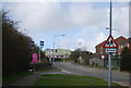
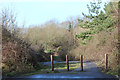
1
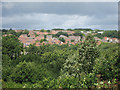
Etchingham Drive under construction, Hollington
On the western edge of Hastings and St Leonards-on-Sea. Etchingham Drive has also been called Mayfield Heights.
Image: © Patrick Roper
Taken: 16 Apr 2013
0.01 miles
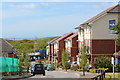
2
Mayfield Heights & Etchingham Drive
Image: © Oast House Archive
Taken: 9 May 2015
0.02 miles
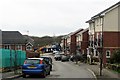
4

Mayfield Heights
New housing estate some now occupied and some under construction.
Image: © Oast House Archive
Taken: 26 Jan 2013
0.04 miles
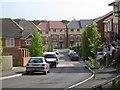
6
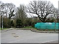
Dead end at Mayfield Heights
This fairly new road seems to rejoice in two names: Mayfield Heights and Etchingham Drive, though the latter may be the more correct.
Image: © Patrick Roper
Taken: 16 Apr 2013
0.07 miles
7
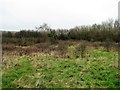
Abandoned field south of Mayfield Lane, Hollington
On the western outskirts of the borough of Hastings and St. Leonards-on-Sea.
Image: © Patrick Roper
Taken: 16 Apr 2013
0.07 miles
8
Development site by Mayfield Lane
Image: © Oast House Archive
Taken: 9 May 2015
0.07 miles
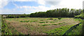
9
Mayfield Lane
A now dead end lane, the road was originally part of the Crowhurst Road lane which has been cut through by the Queensway.
Image: © Oast House Archive
Taken: 26 Jan 2013
0.10 miles