IMAGES TAKEN NEAR TO
Bridge Way, ST. LEONARDS-ON-SEA, TN38 8AP
Introduction
This page details the photographs taken nearby to Bridge Way, TN38 8AP by members of the Geograph project.
The Geograph project started in 2005 with the aim of publishing, organising and preserving representative images for every square kilometre of Great Britain, Ireland and the Isle of Man.

There are currently over 7.5m images from over14,400 individuals and you can help contribute to the project by visiting https://www.geograph.org.uk
Image Map (Loading...)


Getting Data...Please wait
Leaflet Map data © OpenStreetMap
Images are licensed for reuse under creativecommons.org/licenses/by-sa/2.0
Notes
- Clicking on the map will re-center to the selected point.
- The higher the marker number, the further away the image location is from the centre of the postcode.
Image Listing (85 Images Found)
Images are licensed for reuse under creativecommons.org/licenses/by-sa/2.0
Image
Details
Distance
5

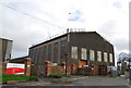
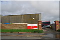
Engine sheds, Bulverhythe, West St Leonards. March 2006.
The old engine sheds at Bulverhythe overlook the Hastings to Eastbourne line and the sea beyond.
Image: © Simon Hookey
Taken: 14 Mar 2006
0.04 miles
6
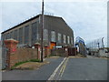
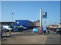
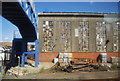
Hastings Municipal Services Depot, Bridge Way
Image: © N Chadwick
Taken: 3 Nov 2009
0.04 miles
9
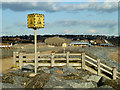
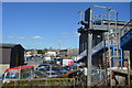
Coastal defences, Bulverhythe
A large amount of imported rock has been dumped along the shore to protect the railway and low lying ground beyond it.
Image: © Robin Webster
Taken: 19 Feb 2012
0.04 miles