IMAGES TAKEN NEAR TO
Sedlescombe Road North, ST. LEONARDS-ON-SEA, TN37 7SF
Introduction
This page details the photographs taken nearby to Sedlescombe Road North, TN37 7SF by members of the Geograph project.
The Geograph project started in 2005 with the aim of publishing, organising and preserving representative images for every square kilometre of Great Britain, Ireland and the Isle of Man.

There are currently over 7.5m images from over14,400 individuals and you can help contribute to the project by visiting https://www.geograph.org.uk
Image Map (Loading...)


Getting Data...Please wait
Leaflet Map data © OpenStreetMap
Images are licensed for reuse under creativecommons.org/licenses/by-sa/2.0
Notes
- Clicking on the map will re-center to the selected point.
- The higher the marker number, the further away the image location is from the centre of the postcode.
Image Listing (105 Images Found)
Images are licensed for reuse under creativecommons.org/licenses/by-sa/2.0
Image
Details
Distance
1
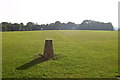
Baldslow trig
In playing fields and close to touchlines.
Image: © Iain Macaulay
Taken: 10 Oct 2005
0.01 miles

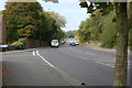
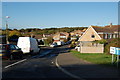
7

A21 in St Leonards after snow
A very quiet Sunday morning after a snow fall.
Image: © Julian P Guffogg
Taken: 5 Feb 2012
0.06 miles
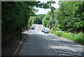
8
Grass area off The Hoe in morning sun
Image: © Oliver P Guffogg
Taken: 18 Oct 2008
0.06 miles
9
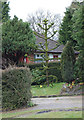
Monkey Puzzle Tree, Sedlescombe Road North, St Leonards
Image: © Julian P Guffogg
Taken: 14 Apr 2013
0.07 miles