IMAGES TAKEN NEAR TO
Kings Road, ST. LEONARDS-ON-SEA, TN37 6DY
Introduction
This page details the photographs taken nearby to Kings Road, TN37 6DY by members of the Geograph project.
The Geograph project started in 2005 with the aim of publishing, organising and preserving representative images for every square kilometre of Great Britain, Ireland and the Isle of Man.

There are currently over 7.5m images from over14,400 individuals and you can help contribute to the project by visiting https://www.geograph.org.uk
Image Map
Images are licensed for reuse under creativecommons.org/licenses/by-sa/2.0
Notes
- Clicking on the map will re-center to the selected point.
- The higher the marker number, the further away the image location is from the centre of the postcode.
Image Listing (567 Images Found)
Images are licensed for reuse under creativecommons.org/licenses/by-sa/2.0
Image
Details
Distance
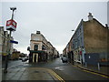
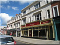
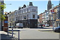
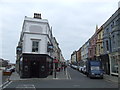
4
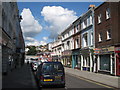
King's Road
Street of shops, leading to station.
Image: © Oast House Archive
Taken: 12 Sep 2010
0.01 miles
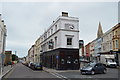
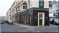
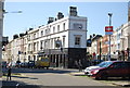
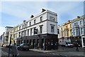
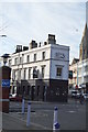
7
The Railway pub, St. Leonard's on Sea
The Railway pub is an unusual narrow wedge-shaped building. As its name suggests, the pub is close to a railway station (St. Leonard's Warrior Square).
Image: © Malc McDonald
Taken: 29 Oct 2011
0.01 miles