IMAGES TAKEN NEAR TO
Watermill Lane, WINCHELSEA, TN36 4AP
Introduction
This page details the photographs taken nearby to Watermill Lane, TN36 4AP by members of the Geograph project.
The Geograph project started in 2005 with the aim of publishing, organising and preserving representative images for every square kilometre of Great Britain, Ireland and the Isle of Man.

There are currently over 7.5m images from over14,400 individuals and you can help contribute to the project by visiting https://www.geograph.org.uk
Image Map (Loading...)


Getting Data...Please wait
Leaflet Map data © OpenStreetMap
Images are licensed for reuse under creativecommons.org/licenses/by-sa/2.0
Notes
- Clicking on the map will re-center to the selected point.
- The higher the marker number, the further away the image location is from the centre of the postcode.
Image Listing (20 Images Found)
Images are licensed for reuse under creativecommons.org/licenses/by-sa/2.0
Image
Details
Distance
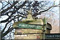
1
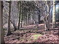
Woodland by Roughters
On footpath from Watermill Lane.
Image: © Oast House Archive
Taken: 8 Mar 2012
0.04 miles
2
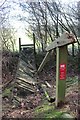
Broken footbridge at Roughters
On footpath to Watermill Lane.
Image: © Oast House Archive
Taken: 8 Mar 2012
0.05 miles
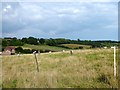
4
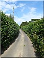
Watermill Lane
Narrow lane linking Pett to Icklesham which has high hedges lining it for much of its length.
Image: © Simon Carey
Taken: 1 Aug 2019
0.07 miles
5
Lions at Roughters
One of a pair of lions on brick piers at the entrance to Roughters.
Image: © Oast House Archive
Taken: 8 Mar 2012
0.08 miles
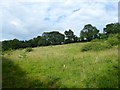
6
Linder Banks
The name of the field according to Icklesham's 1845 tithe map located on the eastern side of Watermill Lane. The house in the distance on the left is Lynthurst.
Image: © Simon Carey
Taken: 1 Aug 2019
0.09 miles
7
Lyndthurst
Looking towards Icklesham village.
Image: © Oast House Archive
Taken: 8 Mar 2012
0.10 miles
8
Spring Field
The name of the field according to Icklesham's 1845 tithe map located to the north of Watermill Lane and east of Old Oast Place.
Image: © Simon Carey
Taken: 1 Aug 2019
0.12 miles
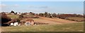
9
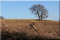
Field by Watermill Lane
A ploughed field with a tree.
Image: © Oast House Archive
Taken: 8 Mar 2012
0.16 miles
10
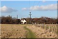
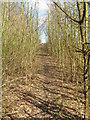
Footpath to Main Road
Footpath from Watermill Lane.
Image: © Oast House Archive
Taken: 8 Mar 2012
0.16 miles