IMAGES TAKEN NEAR TO
Goulds Drive, HASTINGS, TN35 4QY
Introduction
This page details the photographs taken nearby to Goulds Drive, TN35 4QY by members of the Geograph project.
The Geograph project started in 2005 with the aim of publishing, organising and preserving representative images for every square kilometre of Great Britain, Ireland and the Isle of Man.

There are currently over 7.5m images from over14,400 individuals and you can help contribute to the project by visiting https://www.geograph.org.uk
Image Map
Images are licensed for reuse under creativecommons.org/licenses/by-sa/2.0
Notes
- Clicking on the map will re-center to the selected point.
- The higher the marker number, the further away the image location is from the centre of the postcode.
Image Listing (97 Images Found)
Images are licensed for reuse under creativecommons.org/licenses/by-sa/2.0
Image
Details
Distance
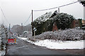
1
Moor Lane
Junction of Stonestile Lane to the left. The house covered in ivy has been derelict for many years.
Image: © Oast House Archive
Taken: 24 Aug 2010
0.04 miles
2
Moor Lane at the junction with Stonestile Lane
Image: © Patrick Roper
Taken: 23 Oct 2006
0.05 miles
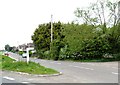
3

Sign at Stonestile Lane and Moor Lane junction
Image: © Oast House Archive
Taken: 29 Mar 2018
0.06 miles
4

Old Direction Sign - Signpost by Moor Lane, Westfield Parish
Black iron cap finial - 3 arms; East Sussex wood by the UC road, in parish of Westfield (Rother District), Moor Lane, on verge at junction with Stonestile Lane.
Surveyed
Milestone Society National ID: SX_TQ8115B
Image: © Milestone Society
Taken: Unknown
0.06 miles
5

Old Direction Sign - Signpost by Moor Lane, Westfield parish
Black iron cap finial - lost, but restored 2016; East Sussex wood by the UC road, in parish of Westfield (Rother District), Moor Lane, on grass triangle at junction of Workhouse Lane with Moor Lane.
Surveyed
Milestone Society National ID: SX_TQ8115A
Image: © Milestone Society
Taken: Unknown
0.08 miles
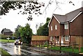
6
Junction of Moor lane and Workhouse lane, Westfield
Image: © Julian P Guffogg
Taken: 26 Jul 2008
0.09 miles

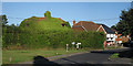
8

Derelict Oast House at Moor Farm, Stonestile Road, Westfield, East Sussex
Unconverted and missing original conical roof, and now covered in ivy.
Image: © Oast House Archive
Taken: 16 Feb 2008
0.09 miles