IMAGES TAKEN NEAR TO
Pett Road, HASTINGS, TN35 4EX
Introduction
This page details the photographs taken nearby to Pett Road, TN35 4EX by members of the Geograph project.
The Geograph project started in 2005 with the aim of publishing, organising and preserving representative images for every square kilometre of Great Britain, Ireland and the Isle of Man.

There are currently over 7.5m images from over14,400 individuals and you can help contribute to the project by visiting https://www.geograph.org.uk
Image Map (Loading...)


Getting Data...Please wait
Leaflet Map data © OpenStreetMap
Images are licensed for reuse under creativecommons.org/licenses/by-sa/2.0
Notes
- Clicking on the map will re-center to the selected point.
- The higher the marker number, the further away the image location is from the centre of the postcode.
Image Listing (37 Images Found)
Images are licensed for reuse under creativecommons.org/licenses/by-sa/2.0
Image
Details
Distance
8
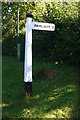
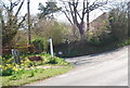
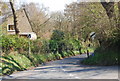
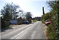
Old Direction Sign - Signpost by Pett Road, Guestling Parish
Black iron cap finial - 1 arm; East Sussex wood by the UC road, in parish of Guestling (Rother District), on verge at junction of Rosemary Lane with Pett Road.
Surveyed
Milestone Society National ID: SX_TQ8613A
Image: © Milestone Society
Taken: Unknown
0.08 miles
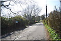
10
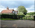
Cheyneys, Shellies Green
Guestling Wood can be seen in the distance.
Image: © Simon Carey
Taken: 1 Aug 2019
0.10 miles