IMAGES TAKEN NEAR TO
The Glebe, HASTINGS, TN34 3PG
Introduction
This page details the photographs taken nearby to The Glebe, TN34 3PG by members of the Geograph project.
The Geograph project started in 2005 with the aim of publishing, organising and preserving representative images for every square kilometre of Great Britain, Ireland and the Isle of Man.

There are currently over 7.5m images from over14,400 individuals and you can help contribute to the project by visiting https://www.geograph.org.uk
Image Map
Images are licensed for reuse under creativecommons.org/licenses/by-sa/2.0
Notes
- Clicking on the map will re-center to the selected point.
- The higher the marker number, the further away the image location is from the centre of the postcode.
Image Listing (112 Images Found)
Images are licensed for reuse under creativecommons.org/licenses/by-sa/2.0
Image
Details
Distance
6
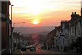
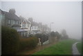
Sunset, Mount Pleasant Road, Hastings, East Sussex
Image: © Oast House Archive
Taken: 27 Sep 2008
0.06 miles
7
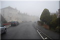
Flats, Bembrook Rd
Taken from Rotherfield Avenue.
Image: © N Chadwick
Taken: 25 Mar 2010
0.07 miles
8
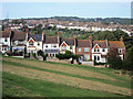
Egremont Place
A steeped terrace of houses going down the hill. Ore is in the distance. Note the solar panels to a house to the left. The roofs are south-west facing.
Image: © Oast House Archive
Taken: 7 Aug 2011
0.07 miles
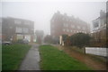
10
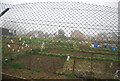
Allotments at the end of Rotherfield Terrace
Image: © N Chadwick
Taken: 25 Mar 2010
0.11 miles