IMAGES TAKEN NEAR TO
Priory Road, HASTINGS, TN34 3JB
Introduction
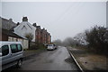
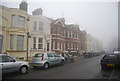
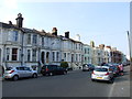
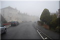
This page details the photographs taken nearby to Priory Road, TN34 3JB by members of the Geograph project.
The Geograph project started in 2005 with the aim of publishing, organising and preserving representative images for every square kilometre of Great Britain, Ireland and the Isle of Man.

There are currently over 7.5m images from over14,400 individuals and you can help contribute to the project by visiting https://www.geograph.org.uk
Image Map
Images are licensed for reuse under creativecommons.org/licenses/by-sa/2.0
Notes
- Clicking on the map will re-center to the selected point.
- The higher the marker number, the further away the image location is from the centre of the postcode.
Image Listing (119 Images Found)
Images are licensed for reuse under creativecommons.org/licenses/by-sa/2.0
Image
Details
Distance
1

Sunset, Mount Pleasant Road, Hastings, East Sussex
Image: © Oast House Archive
Taken: 27 Sep 2008
0.02 miles
9
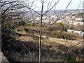
Abandoned allotments at Ore with Hastings beyond
Parts of this site have now been used for housing development. Towards the foreground is the steep concrete path from Mount Pleasant Road to Broomgrove Road.
Image: © Patrick Roper
Taken: 2 Mar 2004
0.08 miles