IMAGES TAKEN NEAR TO
Thanet Way, HASTINGS, TN34 2HP
Introduction
This page details the photographs taken nearby to Thanet Way, TN34 2HP by members of the Geograph project.
The Geograph project started in 2005 with the aim of publishing, organising and preserving representative images for every square kilometre of Great Britain, Ireland and the Isle of Man.

There are currently over 7.5m images from over14,400 individuals and you can help contribute to the project by visiting https://www.geograph.org.uk
Image Map
Images are licensed for reuse under creativecommons.org/licenses/by-sa/2.0
Notes
- Clicking on the map will re-center to the selected point.
- The higher the marker number, the further away the image location is from the centre of the postcode.
Image Listing (137 Images Found)
Images are licensed for reuse under creativecommons.org/licenses/by-sa/2.0
Image
Details
Distance
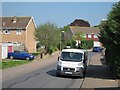
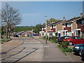
2
House on Manston Way
Rear of terraced houses, seen from Thanet Way.
Image: © Oast House Archive
Taken: 23 Apr 2011
0.04 miles
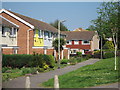
7
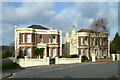
Houses on St. Helen's Crescent
An almost matched pair, but the house on the left lacks ormentation just below the roof.
Image: © Robin Webster
Taken: 31 Jan 2013
0.08 miles
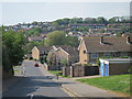
8
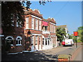
Churchills Hotel & Double Dragon Chinese Restaurant
On St Helen's Crescent.
Image: © Oast House Archive
Taken: 23 Apr 2011
0.10 miles
9
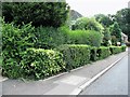
Hedges at the south eastern end of Park View, Hastings
Park View is in the Blacklands area of Hastings
Image: © Patrick Roper
Taken: 8 Aug 2007
0.13 miles
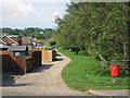
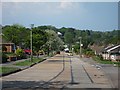
10
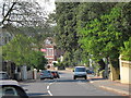
Laton Road
Running past Image to right.
Image: © Oast House Archive
Taken: 23 Apr 2011
0.14 miles