IMAGES TAKEN NEAR TO
Poppinghole Lane, ROBERTSBRIDGE, TN32 5BN
Introduction
This page details the photographs taken nearby to Poppinghole Lane, TN32 5BN by members of the Geograph project.
The Geograph project started in 2005 with the aim of publishing, organising and preserving representative images for every square kilometre of Great Britain, Ireland and the Isle of Man.

There are currently over 7.5m images from over14,400 individuals and you can help contribute to the project by visiting https://www.geograph.org.uk
Image Map (Loading...)


Getting Data...Please wait
Leaflet Map data © OpenStreetMap
Images are licensed for reuse under creativecommons.org/licenses/by-sa/2.0
Notes
- Clicking on the map will re-center to the selected point.
- The higher the marker number, the further away the image location is from the centre of the postcode.
Image Listing (20 Images Found)
Images are licensed for reuse under creativecommons.org/licenses/by-sa/2.0
Image
Details
Distance
3
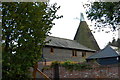
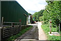
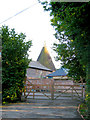
Poppinghole farm Oast
The motif on the vane is a fisherman.
Image: © Julian P Guffogg
Taken: 25 Oct 2009
0.05 miles
6
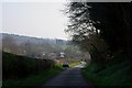
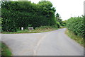
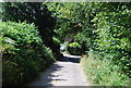
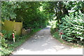
Poppinghole Lane and Newpond Farm
The car is parked opposite a cottage hidden by the hedge.
Image: © Robin Webster
Taken: 2 Apr 2007
0.10 miles