IMAGES TAKEN NEAR TO
Draffin Lane, RYE, TN31 7RA
Introduction
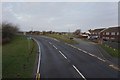
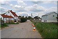
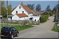
This page details the photographs taken nearby to Draffin Lane, TN31 7RA by members of the Geograph project.
The Geograph project started in 2005 with the aim of publishing, organising and preserving representative images for every square kilometre of Great Britain, Ireland and the Isle of Man.

There are currently over 7.5m images from over14,400 individuals and you can help contribute to the project by visiting https://www.geograph.org.uk
Image Map
Images are licensed for reuse under creativecommons.org/licenses/by-sa/2.0
Notes
- Clicking on the map will re-center to the selected point.
- The higher the marker number, the further away the image location is from the centre of the postcode.
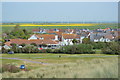
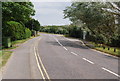
Image Listing (146 Images Found)
Images are licensed for reuse under creativecommons.org/licenses/by-sa/2.0
Image
Details
Distance
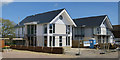
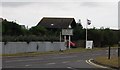
3
New house under construction, Draffin Lane
Image: © Oast House Archive
Taken: 3 May 2016
0.05 miles
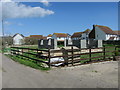
10
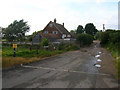
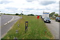
Farm Lane
Private, unmade road at the western end of the village. The gate on the left enters a field which is used as a private car park during the summer season.
Image: © Simon Carey
Taken: 6 Jul 2008
0.08 miles