1
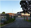
Rye College, The Grove, Rye
Built in the first decade of the 20th century as a grammar school which became Thomas Peacock Secondary Modern in 1969. It was converted into an academy about a decade ago.
Image: © Simon Carey
Taken: 27 Jun 2019
0.05 miles
2
Love Lane, Rye
A cul de sac off The Grove. This is the western end.
Image: © Simon Carey
Taken: 22 Jun 2019
0.05 miles
3
Rye Community Primary School
The colourful arch shaped building is The school and Children's Centre, opened in 2008 and built at a cost of £6m.
Image: © Oast House Archive
Taken: 6 Jun 2010
0.09 miles
4
Compost Toilet, Rye Community Food and Wildlife Garden, Rye
Recently installed and located near to Love Lane.
Image: © Simon Carey
Taken: 27 Jun 2019
0.10 miles
5
View of River Tillingham river valley
As seen from Rye Hill near Rye cemetery.
Rolvendene Farm is on the right
Image: © David Anstiss
Taken: 3 Jul 2011
0.11 miles
6
Sheep on Hill
From High Weald Landscape Trail, near Rolvendene Farm.
Image: © Oast House Archive
Taken: 6 Jun 2010
0.12 miles
7
Rye Community Food and Wildlife Garden, Rye
Originally a field called Butt Marsh according to Rye's 1840 tite map which had become allotment gardens by the 1872 OS map. The current garden was established in 2014. Beyond is Rye Community Primary School opened in 2008 to replace two older schools, Freda Gardham and Thomas Tilling.
Image: © Simon Carey
Taken: 27 Jun 2019
0.12 miles
8
The Grove, Rye
North of the level crossing Rope Walk becomes The Grove, a name it acquired in the early 1900s after the terrace on the left was constructed. Previously it had been a continaution of Rope Walk up to the junction wiuth Deadmans Lane.
Image: © Simon Carey
Taken: 11 Apr 2019
0.12 miles
9
Rye/East Sussex, The Grove
Rye/East Sussex, The Grove, seen from the Marshlink Railway Line level crossing.
Rye is a small town in East Sussex, England, which stands approximately 3 km from the open sea and is at the confluence of three rivers: the Rother, the Tillingham and the Brede.
In medieval times, however, as an important member of the Cinque Ports confederation, it was at the head of an embayment of the English Channel and almost entirely surrounded by the sea.
Rye has a railway station on the "Marshlink" line between Hastings and Ashford.
Image: © Helmut Zozmann
Taken: 27 Jul 2011
0.13 miles
10
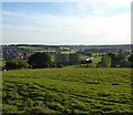
Rolvenden Field
The name of the field according to Rye's 1840 tithe map which is located to the west of the cemetery. The view also takes in the Tillingham Valley and western suburbs of Rye.
Image: © Simon Carey
Taken: 22 Jun 2019
0.14 miles


