1
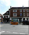
Wealden Hall House, Tenterden
Medieval timber-framed building on Tenterden's High Street.
Note the Maidstone & District Bus Company's board on the side wall.
http://www.tenterdentown.co.uk/index.php
Image: © Colin Smith
Taken: Unknown
0.01 miles
2
Pumpkins and fireworks for sale, Tenterden High Street
Seasonal requirements at Webb's Ironmongery Store, which has been in business for about 100 years http://www.webbsoftenterden.co.uk/page2.htm . The premises are much older, part of a 15th or 16th century timber framed building http://www.imagesofengland.org.uk/details/default.aspx?id=179724 .
Image: © Rose and Trev Clough
Taken: 17 Oct 2009
0.01 miles
3
Old Milestone by the A28, High Street, Tenterden
Carved stone post by the A28, in parish of TENTERDEN (ASHFORD District), High Street, opposite Church Road, by No. 55, Estate Agents, in middle of pavement, on South side of road. Tenterden marker erected by the Bethersden turnpike trust in the 18th century.
Inscription reads:-
: Cranbrook / 8 / Rolvende / 3 : : Romney / 14 / RYE / 10 / Ashford / 12 :
Grade II listed.
List Entry Number: 1363175 https://historicengland.org.uk/listing/the-list/list-entry/1363175
Milestone Society National ID: KE_TTAF00.
Image: © C Woodward
Taken: 30 Jul 2010
0.01 miles
4
53, High Street
It used to be a Your Move estate agents. It is a grade II listed 18th century building https://britishlistedbuildings.co.uk/101025305-53-and-55-high-street-tenterden#.XMC1Bv5Ybcc
Image: © John Baker
Taken: 14 Apr 2019
0.02 miles
5
Tenterden High Street Milestone
The milestone located in Tenterden High Street, opposite Church Road. Grade II Listed; Listing Entry Number:1363175.
Milestone Society National ID: KE_TTAF00. Image Ref:P1290003a2g.
Image: © Phil Brandon Hunter
Taken: 29 Jan 2023
0.02 miles
6
Tenterden High Street Milestone
The milestone located in Tenterden High Street, opposite Church Road. Grade II Listed; Listing Entry Number:1363175.
Milestone Society National ID: KE_TTAF00. Image Ref:P1290005ag.
Image: © Phil Brandon Hunter
Taken: 29 Jan 2023
0.02 miles
7
Tenterden High Street Milestone
The milestone located in Tenterden High Street, opposite Church Road. Grade II Listed; Listing Entry Number:1363175.
Milestone Society National ID: KE_TTAF00. Image Ref:P1290004ag.
Image: © Phil Brandon Hunter
Taken: 29 Jan 2023
0.02 miles
8
Tenterden High Street Milestone
The milestone located in Tenterden High Street, opposite Church Road. Grade II Listed; Listing Entry Number:1363175.
Milestone Society National ID: KE_TTAF00. Image Ref:P1290006ag.
Image: © Phil Brandon Hunter
Taken: 29 Jan 2023
0.02 miles
9
High Street, Tenterden
Image: © Chris Whippet
Taken: 13 Feb 2016
0.02 miles
10
Caf? Rouge, Tenterden
After a fire, spread from the adjacent building, the restaurant is nearing completion of the restoration.
Image: © Oast House Archive
Taken: 21 Apr 2014
0.02 miles


