IMAGES TAKEN NEAR TO
Guldeford Lane, ROMNEY MARSH, TN29 9TH
Introduction
This page details the photographs taken nearby to Guldeford Lane, TN29 9TH by members of the Geograph project.
The Geograph project started in 2005 with the aim of publishing, organising and preserving representative images for every square kilometre of Great Britain, Ireland and the Isle of Man.

There are currently over 7.5m images from over14,400 individuals and you can help contribute to the project by visiting https://www.geograph.org.uk
Image Map
Images are licensed for reuse under creativecommons.org/licenses/by-sa/2.0
Notes
- Clicking on the map will re-center to the selected point.
- The higher the marker number, the further away the image location is from the centre of the postcode.
Image Listing (29 Images Found)
Images are licensed for reuse under creativecommons.org/licenses/by-sa/2.0
Image
Details
Distance
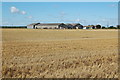
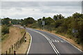
4
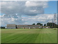
Whitehouse Farm and Turf field
This farm in the Romney Marshes is growing turf to be used in gardens etc.
Image: © David Anstiss
Taken: 12 Sep 2010
0.06 miles
6
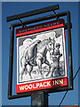
Woolpack Inn sign
Image
The sign is separate from the pub at the junction with Guldeford Lane. Another sign in the same design is beside the pub.
Image: © Oast House Archive
Taken: 22 Jul 2010
0.10 miles
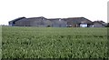
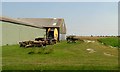
8
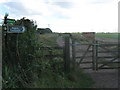
Footpath junction near Whitehouse Farm
This gate beside Beacon Street is on a path leading along a track straight on towards Little Court Farm. Another path to the farm leads right across fields via the Wind Farm.
Image: © David Anstiss
Taken: 12 Sep 2010
0.13 miles
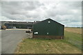
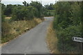
9
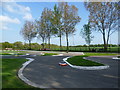
Model car racing at Brookland
Until not so long ago this was the site of the Philippine Craft Centre at Brookland. This was started in 1982 as an attempt to provide a 'window' on the Philippines - its products and its people. The site was an R.A.F camp during the Second World War, providing barracks for radar staff and anti-aircraft gunners. Later it was an R.A.F dog training camp until 1950. It now houses various enterprises, including the model car racing track seen here, a religious centre and a cafe. The model car racing only takes place on certain days. It is an interesting coincidence that the famous 1920s racetrack near Weybridge was called Brooklands.
Many of the facilities are located in the old R.A.F huts. An example is the cafe seen at http://www.geograph.org.uk/photo/3939737
Image: © Marathon
Taken: 19 Apr 2014
0.13 miles