IMAGES TAKEN NEAR TO
Dymchurch Road, ROMNEY MARSH, TN29 0RT
Introduction
This page details the photographs taken nearby to Dymchurch Road, TN29 0RT by members of the Geograph project.
The Geograph project started in 2005 with the aim of publishing, organising and preserving representative images for every square kilometre of Great Britain, Ireland and the Isle of Man.

There are currently over 7.5m images from over14,400 individuals and you can help contribute to the project by visiting https://www.geograph.org.uk
Image Map (Loading...)


Getting Data...Please wait
Leaflet Map data © OpenStreetMap
Images are licensed for reuse under creativecommons.org/licenses/by-sa/2.0
Notes
- Clicking on the map will re-center to the selected point.
- The higher the marker number, the further away the image location is from the centre of the postcode.
Image Listing (124 Images Found)
Images are licensed for reuse under creativecommons.org/licenses/by-sa/2.0
Image
Details
Distance
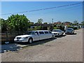
1
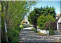
Links Crescent
White limousine to the left.
Image: © Oast House Archive
Taken: 18 Jul 2010
0.03 miles
2
Three cars in Links Crescent
A stretch limousine, a vintage car and a not-so-vintage car parked in Links Crescent, just off Dymchurch Road. Links Crescent is a private road, i.e. it is not maintained by the local highway authority.
Image: © P L Chadwick
Taken: 24 May 2010
0.03 miles
3
Seaway Road
Image: © P L Chadwick
Taken: 24 May 2010
0.03 miles
4
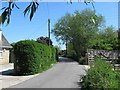
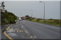
Seaway Road
In this direction the road shortly comes out on Dymchurch Road. On the other side of that road is the seafront.
Image
Image: © P L Chadwick
Taken: 24 May 2010
0.03 miles
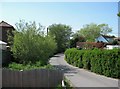
5
Seaway Road
There are a few houses on Seaway Road itself, but mainly the road connects with a maze of residential roads, including Seaway Gardens, and Seaway Crescent.
Image
Image: © P L Chadwick
Taken: 24 May 2010
0.04 miles
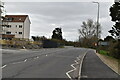
7
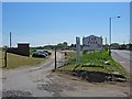
Car park by the seafront (off Dymchurch Road)
The seafront is very near to here.
Image: © P L Chadwick
Taken: 24 May 2010
0.06 miles
8
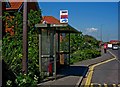
Bus stop and shelter, Dymchurch Road (A259)
This bus stop is labelled Jefferstone Lane, as it just around the corner from that road. The stop is served by Stagecoach buses going in the direction of Dymchurch.
Image: © P L Chadwick
Taken: 24 May 2010
0.06 miles
10
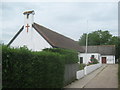
The Parish Church of All Saints
On Jefferson Lane.
Image: © David Anstiss
Taken: 3 Jul 2010
0.07 miles