IMAGES TAKEN NEAR TO
Sussex Road, NEW ROMNEY, TN28 8EG
Introduction
This page details the photographs taken nearby to Sussex Road, TN28 8EG by members of the Geograph project.
The Geograph project started in 2005 with the aim of publishing, organising and preserving representative images for every square kilometre of Great Britain, Ireland and the Isle of Man.

There are currently over 7.5m images from over14,400 individuals and you can help contribute to the project by visiting https://www.geograph.org.uk
Image Map (Loading...)


Getting Data...Please wait
Leaflet Map data © OpenStreetMap
Images are licensed for reuse under creativecommons.org/licenses/by-sa/2.0
Notes
- Clicking on the map will re-center to the selected point.
- The higher the marker number, the further away the image location is from the centre of the postcode.
Image Listing (236 Images Found)
Images are licensed for reuse under creativecommons.org/licenses/by-sa/2.0
Image
Details
Distance
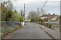
2
Overgrown site, Spitalfield Lane
It lies between the houses known as Willows and Fair View.
Image: © John Baker
Taken: 16 Aug 2015
0.05 miles
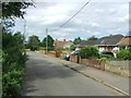
6

Derelict cottages in St John's Road, New Romney in 1969
These cottages were pulled down to be replaced with Image
Image: © John Baker
Taken: 6 Apr 1969
0.06 miles
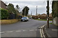
8
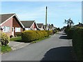
Detached bungalows in St John's Road, New Romney
The electricity pole seems to be common to the picture I took of derelict cottages in 1969 see http://www.geograph.org.uk/photo/1792264
Image: © John Baker
Taken: 6 Apr 2010
0.07 miles