IMAGES TAKEN NEAR TO
Smarden Road, ASHFORD, TN27 0SN
Introduction
This page details the photographs taken nearby to Smarden Road, TN27 0SN by members of the Geograph project.
The Geograph project started in 2005 with the aim of publishing, organising and preserving representative images for every square kilometre of Great Britain, Ireland and the Isle of Man.

There are currently over 7.5m images from over14,400 individuals and you can help contribute to the project by visiting https://www.geograph.org.uk
Image Map (Loading...)


Getting Data...Please wait
Leaflet Map data © OpenStreetMap
Images are licensed for reuse under creativecommons.org/licenses/by-sa/2.0
Notes
- Clicking on the map will re-center to the selected point.
- The higher the marker number, the further away the image location is from the centre of the postcode.
Image Listing (35 Images Found)
Images are licensed for reuse under creativecommons.org/licenses/by-sa/2.0
Image
Details
Distance
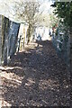
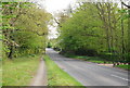
1
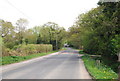
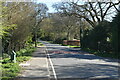
Smarden Rd to Pluckley
Route of the Greensand Way link.
Image: © N Chadwick
Taken: 15 Apr 2011
0.03 miles
3
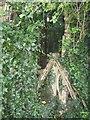
Stile near Arden House on Greensand Way link
This very narrow stile is on the link route for the long distance path, from Pluckley Railway Station to Smarden Road, Pluckley. This stile leads to a narrow path between two gardens.
Image: © David Anstiss
Taken: 2 Aug 2009
0.04 miles
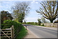
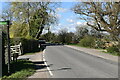
8
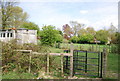
Kissing gates on the Greensand Way link path
Image: © N Chadwick
Taken: 15 Apr 2011
0.09 miles