IMAGES TAKEN NEAR TO
Westwell Lane, ASHFORD, TN27 0BW
Introduction
This page details the photographs taken nearby to Westwell Lane, TN27 0BW by members of the Geograph project.
The Geograph project started in 2005 with the aim of publishing, organising and preserving representative images for every square kilometre of Great Britain, Ireland and the Isle of Man.

There are currently over 7.5m images from over14,400 individuals and you can help contribute to the project by visiting https://www.geograph.org.uk
Image Map
Images are licensed for reuse under creativecommons.org/licenses/by-sa/2.0
Notes
- Clicking on the map will re-center to the selected point.
- The higher the marker number, the further away the image location is from the centre of the postcode.
Image Listing (10 Images Found)
Images are licensed for reuse under creativecommons.org/licenses/by-sa/2.0
Image
Details
Distance
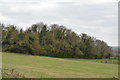
1
Stony field below the North Downs
Winter ploughing had turned up another layer of broken chalk, a perennial problem for downland farmers.
Image: © Stephen Craven
Taken: 30 Jan 2009
0.10 miles
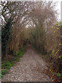
2
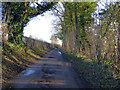
Westwell Lane
Heading east towards Westwell.
Image: © Robin Webster
Taken: 17 Jan 2019
0.10 miles
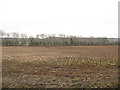
3
Wicken Lane byway
Leads from Westwell lane and Wicken Lane junction to Pilgrim's Way.
Image: © David Anstiss
Taken: 4 Jun 2009
0.14 miles
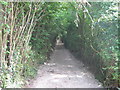
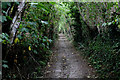
4
Walking along Wicken Lane
Wicken Lane is clearly very old, being a sunken trackway with high banks on either side. It leads from the A20 (Maidstone Road) to the Pilgrim's Way. The southern part is a paved road but between Pett Lane and the Pilgrim's Way it is left as a path as seen here.
Image: © Marathon
Taken: 1 Sep 2013
0.15 miles
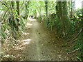
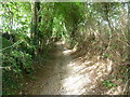
5
Wicken Lane
Ancient sunken track concealed by a green tunnel of vegetation
Image: © Chris Heaton
Taken: 10 Aug 2015
0.15 miles
6
Byway off Wicken Lane
The byway joins to the Pilgrim's Way
Image: © Oast House Archive
Taken: 1 Dec 2009
0.15 miles
7
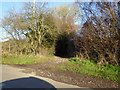
Wicken Lane (byway)
South from here Wicken Lane is a surfaced road, but this is the last stretch up to the Pilgrims' Way.
Image: © Robin Webster
Taken: 17 Jan 2019
0.15 miles
8
Looking up Wicken Lane
Wicken Lane is clearly very old, being a sunken trackway with high banks on either side. It leads from the A20 (Maidstone Road) to the Pilgrim's Way. The southern part is a paved road but between Pett Lane and the Pilgrim's Way it is left as a path as seen here.
Image: © Marathon
Taken: 1 Sep 2013
0.17 miles
9
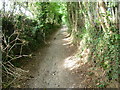
Wicken Lane - an ancient sunken trackway
Wicken Lane is clearly very old, being a sunken trackway with high banks on either side. It leads from the A20 (Maidstone Road) to the Pilgrim's Way. The southern part is a paved road but between Pett Lane and the Pilgrim's Way it is left as a path as seen here.
Image: © Marathon
Taken: 1 Sep 2013
0.19 miles