IMAGES TAKEN NEAR TO
The Street, ASHFORD, TN26 2AF
Introduction
This page details the photographs taken nearby to The Street, TN26 2AF by members of the Geograph project.
The Geograph project started in 2005 with the aim of publishing, organising and preserving representative images for every square kilometre of Great Britain, Ireland and the Isle of Man.

There are currently over 7.5m images from over14,400 individuals and you can help contribute to the project by visiting https://www.geograph.org.uk
Image Map (Loading...)


Getting Data...Please wait
Leaflet Map data © OpenStreetMap
Images are licensed for reuse under creativecommons.org/licenses/by-sa/2.0
Notes
- Clicking on the map will re-center to the selected point.
- The higher the marker number, the further away the image location is from the centre of the postcode.
Image Listing (215 Images Found)
Images are licensed for reuse under creativecommons.org/licenses/by-sa/2.0
Image
Details
Distance
6
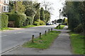
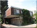
Appledore, The Street (B2080)
Appledore, The Street (B2080).
Appledore is a village and civil parish in the Ashford District of Kent, England. The village centre is 19 km south-west of Ashford town, and on the northern edge of the Romney Marsh.
Image: © Helmut Zozmann
Taken: 23 Jul 2011
0.03 miles
10
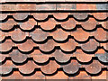
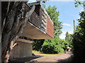
Tile hanging detail, The Plateau
Image: © Oast House Archive
Taken: 21 Jul 2013
0.04 miles