IMAGES TAKEN NEAR TO
Plantation Close, ASHFORD, TN26 1ED
Introduction
This page details the photographs taken nearby to Plantation Close, TN26 1ED by members of the Geograph project.
The Geograph project started in 2005 with the aim of publishing, organising and preserving representative images for every square kilometre of Great Britain, Ireland and the Isle of Man.

There are currently over 7.5m images from over14,400 individuals and you can help contribute to the project by visiting https://www.geograph.org.uk
Image Map (Loading...)


Getting Data...Please wait
Leaflet Map data © OpenStreetMap
Images are licensed for reuse under creativecommons.org/licenses/by-sa/2.0
Notes
- Clicking on the map will re-center to the selected point.
- The higher the marker number, the further away the image location is from the centre of the postcode.
Image Listing (31 Images Found)
Images are licensed for reuse under creativecommons.org/licenses/by-sa/2.0
Image
Details
Distance
3
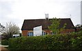
Former village schoolhouse, Hothfield
The inscription reads ‘These schools were erected by the Earl of Thanet in 1834’.
Image: © N Chadwick
Taken: 15 Apr 2011
0.07 miles
4
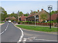
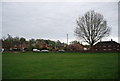
Junction of The Street onto School Road, Hothfield
Image: © Nick Smith
Taken: 23 Apr 2009
0.07 miles
8

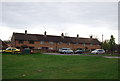
Hothfield primary school, School Road
According to information gained from the internet, this school closed in 2007 but it didn't appear to be closed at the time of our visit in April 2009.
Image: © Nick Smith
Taken: 23 Apr 2009
0.09 miles
9
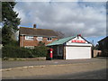
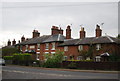
Former Hothfield Post Office Stores
On The Street.
Image: © Oast House Archive
Taken: 4 Mar 2010
0.10 miles