IMAGES TAKEN NEAR TO
Mersham, ASHFORD, TN25 7JB
Introduction
This page details the photographs taken nearby to TN25 7JB by members of the Geograph project.
The Geograph project started in 2005 with the aim of publishing, organising and preserving representative images for every square kilometre of Great Britain, Ireland and the Isle of Man.

There are currently over 7.5m images from over14,400 individuals and you can help contribute to the project by visiting https://www.geograph.org.uk
Image Map
Images are licensed for reuse under creativecommons.org/licenses/by-sa/2.0
Notes
- Clicking on the map will re-center to the selected point.
- The higher the marker number, the further away the image location is from the centre of the postcode.
Image Listing (17 Images Found)
Images are licensed for reuse under creativecommons.org/licenses/by-sa/2.0
Image
Details
Distance
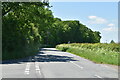
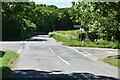
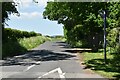
3
Bliby Cross
Bilsington Road from Bilsington leads towards the crossroads. Cheeseman's Green Lane heads straight on towards Cheeseman's Green. A road leads right towards Chequer Tree Farm, or left towards Brockman's Farm and Church Hill.
Image: © David Anstiss
Taken: 26 Sep 2010
0.10 miles
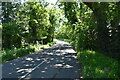
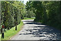
9
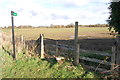
Stile and footpath Entrance at Bliby
Image: © Julian P Guffogg
Taken: 4 Dec 2012
0.12 miles
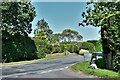
10
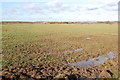
Wet Fields at Bliby
With Ashford in the distance.
Image: © Julian P Guffogg
Taken: 4 Dec 2012
0.13 miles