IMAGES TAKEN NEAR TO
Mersham, ASHFORD, TN25 7HE
Introduction
This page details the photographs taken nearby to TN25 7HE by members of the Geograph project.
The Geograph project started in 2005 with the aim of publishing, organising and preserving representative images for every square kilometre of Great Britain, Ireland and the Isle of Man.

There are currently over 7.5m images from over14,400 individuals and you can help contribute to the project by visiting https://www.geograph.org.uk
Image Map (Loading...)


Getting Data...Please wait
Leaflet Map data © OpenStreetMap
Images are licensed for reuse under creativecommons.org/licenses/by-sa/2.0
Notes
- Clicking on the map will re-center to the selected point.
- The higher the marker number, the further away the image location is from the centre of the postcode.
Image Listing (30 Images Found)
Images are licensed for reuse under creativecommons.org/licenses/by-sa/2.0
Image
Details
Distance
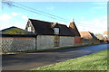
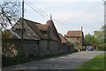
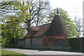
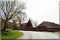
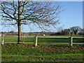
1
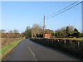
Stonegreen Hall Farm Cottages on the road to Mersham
Image: © Nick Smith
Taken: 17 Jan 2010
0.02 miles
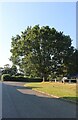
9
Mersham recreation ground on Flood Street
Image: © Nick Smith
Taken: 17 Jan 2010
0.16 miles
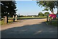
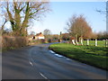
10
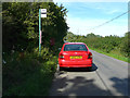
Car parked beside bus stop in Flood Street
Beyond the bus stop is Image
Image: © John Baker
Taken: 12 Jul 2020
0.17 miles