IMAGES TAKEN NEAR TO
Dicksons Bourne, ASHFORD, TN25 7AH
Introduction
This page details the photographs taken nearby to Dicksons Bourne, TN25 7AH by members of the Geograph project.
The Geograph project started in 2005 with the aim of publishing, organising and preserving representative images for every square kilometre of Great Britain, Ireland and the Isle of Man.

There are currently over 7.5m images from over14,400 individuals and you can help contribute to the project by visiting https://www.geograph.org.uk
Image Map
Images are licensed for reuse under creativecommons.org/licenses/by-sa/2.0
Notes
- Clicking on the map will re-center to the selected point.
- The higher the marker number, the further away the image location is from the centre of the postcode.
Image Listing (14 Images Found)
Images are licensed for reuse under creativecommons.org/licenses/by-sa/2.0
Image
Details
Distance
3
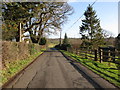
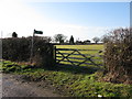
Footpath and small stream from Dicksons Bourne
Image: © Nick Smith
Taken: 17 Jan 2010
0.11 miles
4
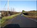
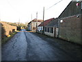
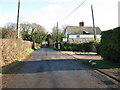
Footpath to Aldington Frith from Dicksons Bourne
Image: © Nick Smith
Taken: 17 Jan 2010
0.11 miles
7
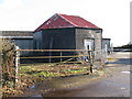
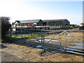
Octagonal building on the corner of Mill Lane
The octagonal building is a former smock windmill see http://www.millarchive.com/kent/millpageData/MillContainer.aspx?millID=2754
Image: © Nick Smith
Taken: 17 Jan 2010
0.12 miles
9
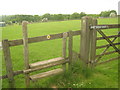
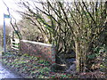
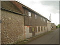
Stile on the Saxon Shore Way on Mill Lane
The long distance path heads from Mill Lane down to Patlan Farm on Cherry Orchard Lane.
Image: © David Anstiss
Taken: 30 May 2010
0.15 miles