IMAGES TAKEN NEAR TO
Church Lane, ASHFORD, TN25 4FB
Introduction
This page details the photographs taken nearby to Church Lane, TN25 4FB by members of the Geograph project.
The Geograph project started in 2005 with the aim of publishing, organising and preserving representative images for every square kilometre of Great Britain, Ireland and the Isle of Man.

There are currently over 7.5m images from over14,400 individuals and you can help contribute to the project by visiting https://www.geograph.org.uk
Image Map
Images are licensed for reuse under creativecommons.org/licenses/by-sa/2.0
Notes
- Clicking on the map will re-center to the selected point.
- The higher the marker number, the further away the image location is from the centre of the postcode.
Image Listing (14 Images Found)
Images are licensed for reuse under creativecommons.org/licenses/by-sa/2.0
Image
Details
Distance
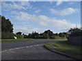
1
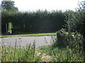
Lane junction, Boughton Aluph
Church Lane to the left is a dead-end.
Image: © Robin Webster
Taken: 8 Jul 2017
0.18 miles
2
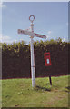
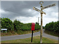
Old Direction Sign - Signpost by Church Lane, near Boughton Aluph
Annulus finial - 3 arms; Kent parish small halo by the UC road, in parish of Boughton Aluph (Ashford District), Church Lane, junction with Pilgrims Way (Malthouse lane), on grass triangle by post box.
Surveyed
Milestone Society National ID: KE_TR0347.
Image: © Milestone Society
Taken: Unknown
0.18 miles
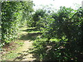
3
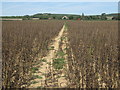
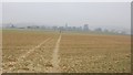
Footpath to Boughton Aluph
This path leads from A28 Canterbury Road to All Saints Church. The North Downs is in the background.
Image: © David Anstiss
Taken: 23 Aug 2009
0.18 miles
4
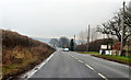
Canterbury Road at Perry Court Farm
One of several straight Roman Roads in the area.
Image: © J.Hannan-Briggs
Taken: 30 Mar 2013
0.19 miles
6
The North Downs Way crosses the A28 Canterbury Road
The long distance path heads towards Wye from Boughton Lees. Another path heads behind the viewer to the Pilgrims Way road to Boughton Aluph.
Image: © David Anstiss
Taken: 23 Aug 2009
0.21 miles
8
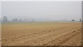
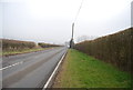
North Downs Way past Perry Court Farm
The long distance path heads past the Orchard towards Wye, from the A28 Canterbury Road.
Image: © David Anstiss
Taken: 23 Aug 2009
0.22 miles