IMAGES TAKEN NEAR TO
Kempes Corner, ASHFORD, TN25 4ER
Introduction
This page details the photographs taken nearby to Kempes Corner, TN25 4ER by members of the Geograph project.
The Geograph project started in 2005 with the aim of publishing, organising and preserving representative images for every square kilometre of Great Britain, Ireland and the Isle of Man.

There are currently over 7.5m images from over14,400 individuals and you can help contribute to the project by visiting https://www.geograph.org.uk
Image Map
Images are licensed for reuse under creativecommons.org/licenses/by-sa/2.0
Notes
- Clicking on the map will re-center to the selected point.
- The higher the marker number, the further away the image location is from the centre of the postcode.
Image Listing (25 Images Found)
Images are licensed for reuse under creativecommons.org/licenses/by-sa/2.0
Image
Details
Distance
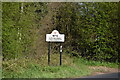
3
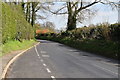
Harville Road
From Wye to Kempe's Corner on the A28.
Image: © Robin Webster
Taken: 2 Aug 2018
0.03 miles
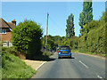
6
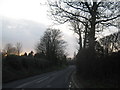
Harville Road
This road leads from Wye towards Kempe's Corner on the A28 Canterbury Road.
Image: © David Anstiss
Taken: 21 Mar 2010
0.10 miles
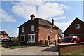
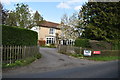
8
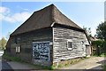
Barn at Kempe's Corner
Grade II listed. https://historicengland.org.uk/listing/the-list/list-entry/1184864
Image: © N Chadwick
Taken: 11 Apr 2019
0.13 miles
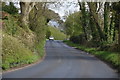
10
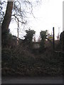
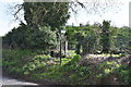
Steps and stile to a footpath on Harville Road.
This footpath leads to the A28 Canterbury Road near Wilmington Farm.
It passes through a plant nursery so a CCTV Camera watches the walker.
Image: © David Anstiss
Taken: 21 Mar 2010
0.15 miles