IMAGES TAKEN NEAR TO
St. Peters Street, TUNBRIDGE WELLS, TN2 4UX
Introduction
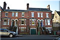
This page details the photographs taken nearby to St. Peters Street, TN2 4UX by members of the Geograph project.
The Geograph project started in 2005 with the aim of publishing, organising and preserving representative images for every square kilometre of Great Britain, Ireland and the Isle of Man.

There are currently over 7.5m images from over14,400 individuals and you can help contribute to the project by visiting https://www.geograph.org.uk
Image Map
Images are licensed for reuse under creativecommons.org/licenses/by-sa/2.0
Notes
- Clicking on the map will re-center to the selected point.
- The higher the marker number, the further away the image location is from the centre of the postcode.
Image Listing (479 Images Found)
Images are licensed for reuse under creativecommons.org/licenses/by-sa/2.0
Image
Details
Distance
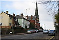
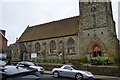
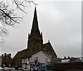
1
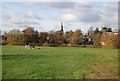
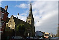
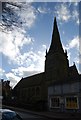
St Peter's Church spire across Dunorlan park
Image: © N Chadwick
Taken: 22 Nov 2008
0.01 miles
3
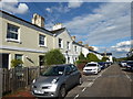
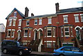
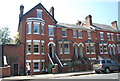
Windmill Street, Tunbridge Wells
Windmill Street is a one-way road of terraced houses off Bayhall Road. Lack of garages and the small front gardens mean that it is impossible to take photographs without cars.
Image: © Marathon
Taken: 11 Jul 2020
0.02 miles