IMAGES TAKEN NEAR TO
Kennington Road, ASHFORD, TN24 0LU
Introduction
This page details the photographs taken nearby to Kennington Road, TN24 0LU by members of the Geograph project.
The Geograph project started in 2005 with the aim of publishing, organising and preserving representative images for every square kilometre of Great Britain, Ireland and the Isle of Man.

There are currently over 7.5m images from over14,400 individuals and you can help contribute to the project by visiting https://www.geograph.org.uk
Image Map
Images are licensed for reuse under creativecommons.org/licenses/by-sa/2.0
Notes
- Clicking on the map will re-center to the selected point.
- The higher the marker number, the further away the image location is from the centre of the postcode.
Image Listing (29 Images Found)
Images are licensed for reuse under creativecommons.org/licenses/by-sa/2.0
Image
Details
Distance
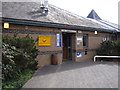
1
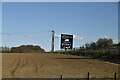
Batchelors factory
Cup a soup factory by Williesborough Road.
Image: © Oast House Archive
Taken: 31 Jul 2011
0.05 miles
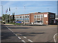
2
Willesborough Road
Batchelors factory to the right.
Image: © Oast House Archive
Taken: 31 Jul 2011
0.06 miles


5
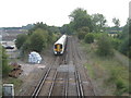
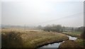
Railway towards Ashford, Train heading to Canterbury
This railway heads towards Ashford Station from the Canterbury, Margate line.
The train is heading towards A2070 Willesborough Road bridge.
Image: © David Anstiss
Taken: 8 Aug 2009
0.10 miles

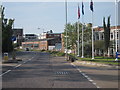
9
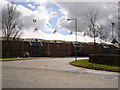
Julie Rose Athletic Stadium
Covered stand outside from entrance road
Image: © D-G-Seamon
Taken: 4 Apr 2007
0.12 miles