IMAGES TAKEN NEAR TO
Cressfield, ASHFORD, TN23 4XB
Introduction
This page details the photographs taken nearby to Cressfield, TN23 4XB by members of the Geograph project.
The Geograph project started in 2005 with the aim of publishing, organising and preserving representative images for every square kilometre of Great Britain, Ireland and the Isle of Man.

There are currently over 7.5m images from over14,400 individuals and you can help contribute to the project by visiting https://www.geograph.org.uk
Image Map
Images are licensed for reuse under creativecommons.org/licenses/by-sa/2.0
Notes
- Clicking on the map will re-center to the selected point.
- The higher the marker number, the further away the image location is from the centre of the postcode.
Image Listing (36 Images Found)
Images are licensed for reuse under creativecommons.org/licenses/by-sa/2.0
Image
Details
Distance
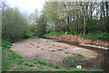
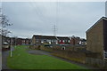
4
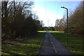
Path across Watercress Field to Ford Way
Image: © Robert Eva
Taken: 30 Nov 2018
0.10 miles
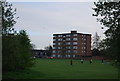
10
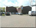
Great Chart Motors
Seen from Capel Close. This was the Image
Image: © John Baker
Taken: 9 May 2013
0.16 miles