IMAGES TAKEN NEAR TO
Ninn Lane, ASHFORD, TN23 3DA
Introduction
This page details the photographs taken nearby to Ninn Lane, TN23 3DA by members of the Geograph project.
The Geograph project started in 2005 with the aim of publishing, organising and preserving representative images for every square kilometre of Great Britain, Ireland and the Isle of Man.

There are currently over 7.5m images from over14,400 individuals and you can help contribute to the project by visiting https://www.geograph.org.uk
Image Map
Images are licensed for reuse under creativecommons.org/licenses/by-sa/2.0
Notes
- Clicking on the map will re-center to the selected point.
- The higher the marker number, the further away the image location is from the centre of the postcode.
Image Listing (14 Images Found)
Images are licensed for reuse under creativecommons.org/licenses/by-sa/2.0
Image
Details
Distance
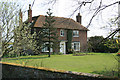
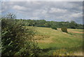
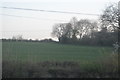
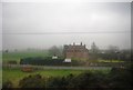
3
Ninn Lodge Farm, Ninn Lane
Looking East on Ninn Lane. The railway runs parallel to the road for about 1km.
Image: © Oast House Archive
Taken: 12 Feb 2010
0.04 miles
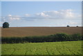
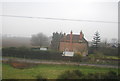
5
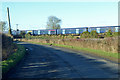
Road and railway
Ninn Lane veers round to run closely parallel with the railway for some distance.
Image: © Robin Webster
Taken: 17 Jan 2019
0.07 miles