IMAGES TAKEN NEAR TO
Terminus Road, UCKFIELD, TN22 5LY
Introduction
This page details the photographs taken nearby to Terminus Road, TN22 5LY by members of the Geograph project.
The Geograph project started in 2005 with the aim of publishing, organising and preserving representative images for every square kilometre of Great Britain, Ireland and the Isle of Man.

There are currently over 7.5m images from over14,400 individuals and you can help contribute to the project by visiting https://www.geograph.org.uk
Image Map
Images are licensed for reuse under creativecommons.org/licenses/by-sa/2.0
Notes
- Clicking on the map will re-center to the selected point.
- The higher the marker number, the further away the image location is from the centre of the postcode.
Image Listing (43 Images Found)
Images are licensed for reuse under creativecommons.org/licenses/by-sa/2.0
Image
Details
Distance
9
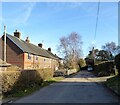
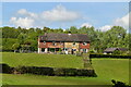
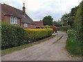
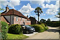
Terminus Road, Blackboys
A private road off Tickerage Lane that ends at Ralph's Farm. The cottages on the left date from the 19th century, Framfield's 1840 tithe map lists the plot as containing three cottages, whilst the 1898 OS map has four. The nearest cottage's roof and brickwork seem to point to that one being the extension.
Image: © Simon Carey
Taken: 5 Feb 2023
0.13 miles