IMAGES TAKEN NEAR TO
Station Road, UCKFIELD, TN22 4DP
Introduction
This page details the photographs taken nearby to Station Road, TN22 4DP by members of the Geograph project.
The Geograph project started in 2005 with the aim of publishing, organising and preserving representative images for every square kilometre of Great Britain, Ireland and the Isle of Man.

There are currently over 7.5m images from over14,400 individuals and you can help contribute to the project by visiting https://www.geograph.org.uk
Image Map
Images are licensed for reuse under creativecommons.org/licenses/by-sa/2.0
Notes
- Clicking on the map will re-center to the selected point.
- The higher the marker number, the further away the image location is from the centre of the postcode.
Image Listing (42 Images Found)
Images are licensed for reuse under creativecommons.org/licenses/by-sa/2.0
Image
Details
Distance
1

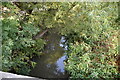
Water monitoring unit on the River Uck at Buxted
Image: © Dave Spicer
Taken: 25 May 2013
0.01 miles
7
Private road to electricity sub-station
Opposite the White Hart pub at Buxted
Image: © Robert Eva
Taken: 22 Apr 2017
0.06 miles