IMAGES TAKEN NEAR TO
Brookhouse Bottom, UCKFIELD, TN22 3RP
Introduction
This page details the photographs taken nearby to Brookhouse Bottom, TN22 3RP by members of the Geograph project.
The Geograph project started in 2005 with the aim of publishing, organising and preserving representative images for every square kilometre of Great Britain, Ireland and the Isle of Man.

There are currently over 7.5m images from over14,400 individuals and you can help contribute to the project by visiting https://www.geograph.org.uk
Image Map (Loading...)


Getting Data...Please wait
Leaflet Map data © OpenStreetMap
Images are licensed for reuse under creativecommons.org/licenses/by-sa/2.0
Notes
- Clicking on the map will re-center to the selected point.
- The higher the marker number, the further away the image location is from the centre of the postcode.
Image Listing (8 Images Found)
Images are licensed for reuse under creativecommons.org/licenses/by-sa/2.0
Image
Details
Distance
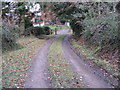
3
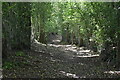
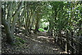
Road from Brookhouse Bottom
Approaching the road junction on Tanyard Lane with the road from Brookhouse Bottom.
Image: © Chris Thomas-Atkin
Taken: 18 May 2018
0.21 miles
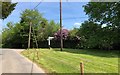
4

Old Direction Sign - Signpost by Tanyard Lane, Danehill Parish
Black iron cap finial - 3 arms; East Sussex wood by the UC road, in parish of Danehill (Wealden District), Tanyard Lane Y-junction with Brookhouse Bottom, on grass triangle at junction.
Surveyed
Milestone Society National ID: SX_TQ4128C
Image: © Milestone Society
Taken: Unknown
0.22 miles
5
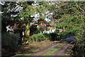
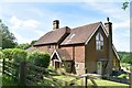
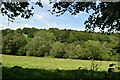
Allin's Farm
The drive is a public footpath. The farm is only residential now.
Image: © Robin Webster
Taken: 5 Feb 2010
0.22 miles