IMAGES TAKEN NEAR TO
Fairwarp, UCKFIELD, TN22 3DT
Introduction
This page details the photographs taken nearby to TN22 3DT by members of the Geograph project.
The Geograph project started in 2005 with the aim of publishing, organising and preserving representative images for every square kilometre of Great Britain, Ireland and the Isle of Man.

There are currently over 7.5m images from over14,400 individuals and you can help contribute to the project by visiting https://www.geograph.org.uk
Image Map (Loading...)


Getting Data...Please wait
Leaflet Map data © OpenStreetMap
Images are licensed for reuse under creativecommons.org/licenses/by-sa/2.0
Notes
- Clicking on the map will re-center to the selected point.
- The higher the marker number, the further away the image location is from the centre of the postcode.
Image Listing (46 Images Found)
Images are licensed for reuse under creativecommons.org/licenses/by-sa/2.0
Image
Details
Distance
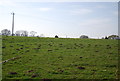
1
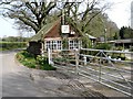
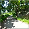
Lampool Road
The name of the section of the B2026 between its southern junction with Straight Half Mile and the junctions of Nursery Lane and Toll Lane where it becomes Duddleswell Road. Beyond the signpost indicating the junction with Old Forge Lane was once the site Lampool Gate, a former entrance to the medieval deer park of Ashdown Forest. The B2026 is an ancient droving route and may well predate the existence of the forest and still traverses the length of the forest exiting at Chuck Hatch.
Image: © Simon Carey
Taken: 22 May 2022
0.04 miles
2
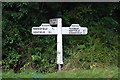
Old Direction Sign - Signpost by the B2026, Maresfield parish
Black iron cap finial - 3 arms; East Sussex wood with number by the B2026, in parish of Maresfield (Wealden District), junction with Old Forge Lane, on verge.
Surveyed
Milestone Society National ID: SX_TQ4626
Image: © Milestone Society
Taken: Unknown
0.05 miles
3
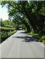
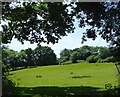
Acre Mead
The name of the field according to Maresfield's 1840 tithe map bounded by Lampool road to the west and Cophall farm to the east.
Image: © Simon Carey
Taken: 22 May 2022
0.08 miles
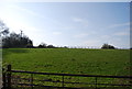
4
The Slip
The name of the field according to Maresfield's 1840 tithe map bounded by Nursery Lane to the east. The southern boundary in view utilises the former medieval pale of Ashdown forest deer park.
Image: © Simon Carey
Taken: 22 May 2022
0.12 miles
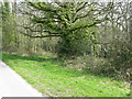
6
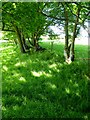
Medieval Pale, Ashdown Forest
Located on the western side of Nursery Lane at the site of the former Tyes Hatch and utilised these days as a field boundary.
Image: © Simon Carey
Taken: 22 May 2022
0.13 miles
8
Site of Tyes Hatch
The point where Nursery Lane enters Ashdown Forest also marks the southern most entrance to the medieval deer park. Beyond the land to the east is still open common whilst that to the west has been enclosed into fields.
Image: © Simon Carey
Taken: 22 May 2022
0.14 miles
9
Footpath branching off Nursery Lane south of Fairwarp
Fairwarp is enclosed by Access land.
Image: © Dave Spicer
Taken: 18 Apr 2010
0.14 miles