IMAGES TAKEN NEAR TO
Rushlake Green, HEATHFIELD, TN21 9QU
Introduction
This page details the photographs taken nearby to TN21 9QU by members of the Geograph project.
The Geograph project started in 2005 with the aim of publishing, organising and preserving representative images for every square kilometre of Great Britain, Ireland and the Isle of Man.

There are currently over 7.5m images from over14,400 individuals and you can help contribute to the project by visiting https://www.geograph.org.uk
Image Map (Loading...)


Getting Data...Please wait
Leaflet Map data © OpenStreetMap
Images are licensed for reuse under creativecommons.org/licenses/by-sa/2.0
Notes
- Clicking on the map will re-center to the selected point.
- The higher the marker number, the further away the image location is from the centre of the postcode.
Image Listing (41 Images Found)
Images are licensed for reuse under creativecommons.org/licenses/by-sa/2.0
Image
Details
Distance
2
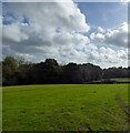
Tory Meadow
The name of the field according to Warbleton's 1838 tithe map located to the south east of Dean Farm. The woodland in the distance was the site of Warbleton Priory Furnace.
Image: © Simon Carey
Taken: 26 Oct 2022
0.06 miles
3
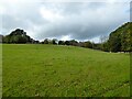
Furnace Field
The name of the field according to Warbleton's 1838 tithe map bounded to the east and north by Christian's River and named after the nearby Warbleton Priory Furnace.
Image: © Simon Carey
Taken: 26 Oct 2022
0.07 miles
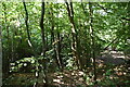
7
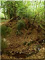
Pond Bay, Warbleton Priory Furnace (2)
A view from the top of the eastern side of the pond bay across Christian's River to the remaining portion. There are records of a waterway further west that may have allowed the river to bypass the site, however, the bay could also have had a spillway allowing water egress to power a possible wheel pit at this point. Added to this is the possibility of two different working areas of furnace. Since the site's closure the river has been allowed to breach the bay completely which gives a good indication of the actual height of the earthworks. See also Image
Image: © Simon Carey
Taken: 26 Oct 2022
0.11 miles
8
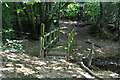
Christian's River
Rising in Hoad's Wood to the north and part of the catchment area that drains into the Pevensey Levels.
Image: © Simon Carey
Taken: 26 Oct 2022
0.11 miles
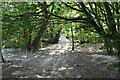
10
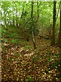
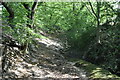
Possible Leat, Warbleton Priory Furnace
A leat was recorded running south from Christian's River to the site of the furnace with this dip suggesting this was its course. Its position on the slope allowed the use of gravity to speed up the water as it approached the wheel pit.
Image: © Simon Carey
Taken: 26 Oct 2022
0.11 miles