IMAGES TAKEN NEAR TO
Cuckmere Rise, HEATHFIELD, TN21 8PG
Introduction
This page details the photographs taken nearby to Cuckmere Rise, TN21 8PG by members of the Geograph project.
The Geograph project started in 2005 with the aim of publishing, organising and preserving representative images for every square kilometre of Great Britain, Ireland and the Isle of Man.

There are currently over 7.5m images from over14,400 individuals and you can help contribute to the project by visiting https://www.geograph.org.uk
Image Map (Loading...)


Getting Data...Please wait
Leaflet Map data © OpenStreetMap
Images are licensed for reuse under creativecommons.org/licenses/by-sa/2.0
Notes
- Clicking on the map will re-center to the selected point.
- The higher the marker number, the further away the image location is from the centre of the postcode.
Image Listing (17 Images Found)
Images are licensed for reuse under creativecommons.org/licenses/by-sa/2.0
Image
Details
Distance
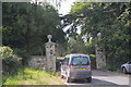
1
Browning Road, Heathfield
Site of Heathfield's former station, the old station building can still be seen in the centre of the picture behind the trees. This is also the current northernmost point of the Cuckoo Trail.
Image: © Simon Carey
Taken: 20 Aug 2005
0.04 miles
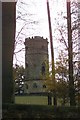
2
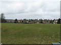
View NW across Heathfield from the recreation ground
In the distance is the tall TV and radio mast at Cross in Hand.
Image: © Dave Spicer
Taken: 15 Apr 2013
0.07 miles