IMAGES TAKEN NEAR TO
Grange Close, HEATHFIELD, TN21 0EE
Introduction
This page details the photographs taken nearby to Grange Close, TN21 0EE by members of the Geograph project.
The Geograph project started in 2005 with the aim of publishing, organising and preserving representative images for every square kilometre of Great Britain, Ireland and the Isle of Man.

There are currently over 7.5m images from over14,400 individuals and you can help contribute to the project by visiting https://www.geograph.org.uk
Image Map
Images are licensed for reuse under creativecommons.org/licenses/by-sa/2.0
Notes
- Clicking on the map will re-center to the selected point.
- The higher the marker number, the further away the image location is from the centre of the postcode.
Image Listing (49 Images Found)
Images are licensed for reuse under creativecommons.org/licenses/by-sa/2.0
Image
Details
Distance
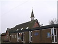

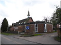
7
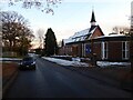
Christ Church, Horebeech Lane, Horam
Consecrated in 1890 to serve the new parish of Horam which had grown considerably since the arrival of the railway ten years earlier.
Image: © Simon Carey
Taken: 17 Dec 2022
0.09 miles
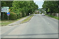
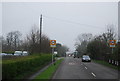
9
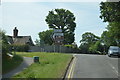
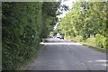
A267 at Horam
The junction of the A267 with Horebeech Lane in Horam.
Image: © Chris Thomas-Atkin
Taken: 17 Feb 2019
0.09 miles
10
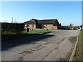
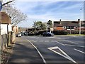
Horam Village Hall
Horam derives its name from 'horh ham', a settlement on or near dirty or muddy ground.
Image: © Dave Spicer
Taken: 13 Nov 2011
0.09 miles