IMAGES TAKEN NEAR TO
Dunstans Croft, MAYFIELD, TN20 6UH
Introduction
This page details the photographs taken nearby to Dunstans Croft, TN20 6UH by members of the Geograph project.
The Geograph project started in 2005 with the aim of publishing, organising and preserving representative images for every square kilometre of Great Britain, Ireland and the Isle of Man.

There are currently over 7.5m images from over14,400 individuals and you can help contribute to the project by visiting https://www.geograph.org.uk
Image Map
Images are licensed for reuse under creativecommons.org/licenses/by-sa/2.0
Notes
- Clicking on the map will re-center to the selected point.
- The higher the marker number, the further away the image location is from the centre of the postcode.
Image Listing (63 Images Found)
Images are licensed for reuse under creativecommons.org/licenses/by-sa/2.0
Image
Details
Distance
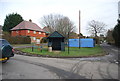
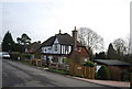
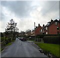
1
Alexandra Road
Two rows of terraced houses.
Image: © Oast House Archive
Taken: 27 Nov 2011
0.07 miles
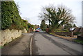
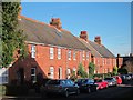
2
Southmead Close, Mayfield
A cul de sac off East Street built in the late 1940s.
Image: © Simon Carey
Taken: 29 Dec 2022
0.08 miles
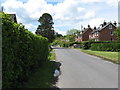
3
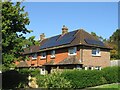
Solar power on Southmead Close
Many of the homes on the close take advantage of their south-facing location to sport solar panels.
Image: © David M Clark
Taken: 29 Aug 2024
0.09 miles
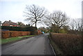
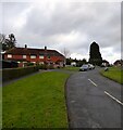
4
East Street, Mayfield
Looking westwards from the junction with Southmead Close.
Image: © Simon Carey
Taken: 29 Dec 2022
0.11 miles