IMAGES TAKEN NEAR TO
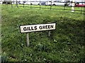
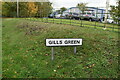
Gills Green, CRANBROOK, TN18 5EW
Introduction
This page details the photographs taken nearby to TN18 5EW by members of the Geograph project.
The Geograph project started in 2005 with the aim of publishing, organising and preserving representative images for every square kilometre of Great Britain, Ireland and the Isle of Man.

There are currently over 7.5m images from over14,400 individuals and you can help contribute to the project by visiting https://www.geograph.org.uk
Image Map (Loading...)


Getting Data...Please wait
Leaflet Map data © OpenStreetMap
Images are licensed for reuse under creativecommons.org/licenses/by-sa/2.0
Notes
- Clicking on the map will re-center to the selected point.
- The higher the marker number, the further away the image location is from the centre of the postcode.
Image Listing (38 Images Found)
Images are licensed for reuse under creativecommons.org/licenses/by-sa/2.0
Image
Details
Distance
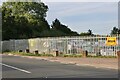
3
Hawkhurst Road, Gill's Green
High Banks Nurseries is on the right.
Image: © David Howard
Taken: 28 Aug 2022
0.05 miles


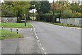
10
Potter's Lane
Named for Potter's Farm, some way ahead.
Image: © Robin Webster
Taken: 16 Feb 2014
0.11 miles