IMAGES TAKEN NEAR TO
Hartley Road, CRANBROOK, TN17 3PT
Introduction
This page details the photographs taken nearby to Hartley Road, TN17 3PT by members of the Geograph project.
The Geograph project started in 2005 with the aim of publishing, organising and preserving representative images for every square kilometre of Great Britain, Ireland and the Isle of Man.

There are currently over 7.5m images from over14,400 individuals and you can help contribute to the project by visiting https://www.geograph.org.uk
Image Map
Images are licensed for reuse under creativecommons.org/licenses/by-sa/2.0
Notes
- Clicking on the map will re-center to the selected point.
- The higher the marker number, the further away the image location is from the centre of the postcode.
Image Listing (42 Images Found)
Images are licensed for reuse under creativecommons.org/licenses/by-sa/2.0
Image
Details
Distance
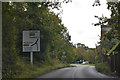
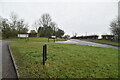
6
Lorry turning into Glassenbury Road, Hartley
A turn onto the B2085 towards Goudhurst off the A229.
Image: © Robin Webster
Taken: 23 May 2018
0.08 miles
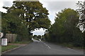
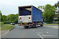
7
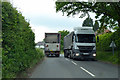
HGVs on B2086, Swattenden Lane
The oncoming truck had stopped as the road narrowed somewhat behind the camera.
Image: © Robin Webster
Taken: 23 May 2018
0.08 miles

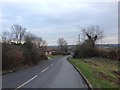
9
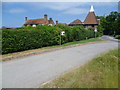
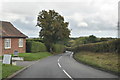
Bull Farm Oast
The photograph was taken standing on the edge of Hartley Road (A229), with Glassenbury Road ahead. For more information on Bull Farm Oast see http://www.geograph.org.uk/photo/1017688
Image: © Marathon
Taken: 23 Jun 2014
0.09 miles