IMAGES TAKEN NEAR TO
New Road, CRANBROOK, TN17 3LE
Introduction
This page details the photographs taken nearby to New Road, TN17 3LE by members of the Geograph project.
The Geograph project started in 2005 with the aim of publishing, organising and preserving representative images for every square kilometre of Great Britain, Ireland and the Isle of Man.

There are currently over 7.5m images from over14,400 individuals and you can help contribute to the project by visiting https://www.geograph.org.uk
Image Map (Loading...)


Getting Data...Please wait
Leaflet Map data © OpenStreetMap
Images are licensed for reuse under creativecommons.org/licenses/by-sa/2.0
Notes
- Clicking on the map will re-center to the selected point.
- The higher the marker number, the further away the image location is from the centre of the postcode.
Image Listing (87 Images Found)
Images are licensed for reuse under creativecommons.org/licenses/by-sa/2.0
Image
Details
Distance
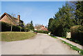
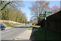
3
New Rd, Cranbrook (2)
Route of the HWLT.
Image: © N Chadwick
Taken: 10 Apr 2010
0.03 miles

6
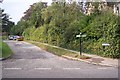
The High Weald Landscape Trail on New Road, Cranbrook
The long distance path heads right along Cranbrook High Street into the town centre. It also heads along left along New Road towards Angley Road and Angley Wood.
Image: © David Anstiss
Taken: 20 Sep 2009
0.05 miles
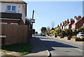
9
High Weald Landscape Trail sign, Angley Rd
Image: © N Chadwick
Taken: 10 Apr 2010
0.07 miles