IMAGES TAKEN NEAR TO
Causton Road, CRANBROOK, TN17 3ES
Introduction
This page details the photographs taken nearby to Causton Road, TN17 3ES by members of the Geograph project.
The Geograph project started in 2005 with the aim of publishing, organising and preserving representative images for every square kilometre of Great Britain, Ireland and the Isle of Man.

There are currently over 7.5m images from over14,400 individuals and you can help contribute to the project by visiting https://www.geograph.org.uk
Image Map (Loading...)


Getting Data...Please wait
Leaflet Map data © OpenStreetMap
Images are licensed for reuse under creativecommons.org/licenses/by-sa/2.0
Notes
- Clicking on the map will re-center to the selected point.
- The higher the marker number, the further away the image location is from the centre of the postcode.
Image Listing (391 Images Found)
Images are licensed for reuse under creativecommons.org/licenses/by-sa/2.0
Image
Details
Distance
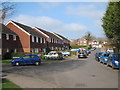
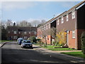
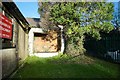
4
Causton Road Cranbrook by Cranbrook Drill Hall Entrance
Image: © Peter Skynner
Taken: 19 Dec 2014
0.05 miles
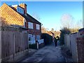
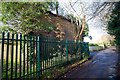
7
Cranbrook Drill Hall WW2 Era Store Hut Causton Road Cranbrook
Defying Gravity
Image: © Peter Skynner
Taken: 19 Dec 2014
0.06 miles
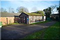
8
Cramp Institute Club High Street Cranbrook
Image: © Peter Skynner
Taken: 19 Dec 2014
0.06 miles
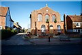
9
Cranbrook Drill Hall Small Bore Rifle Range Target End AC Causton Road Cranbrook
Image: © Peter Skynner
Taken: 19 Dec 2014
0.06 miles
10
Cranbrook Drill Hall Small Bore Rifle Range Butts End Causton Road Cranbrook
Image: © Peter Skynner
Taken: 19 Dec 2014
0.06 miles